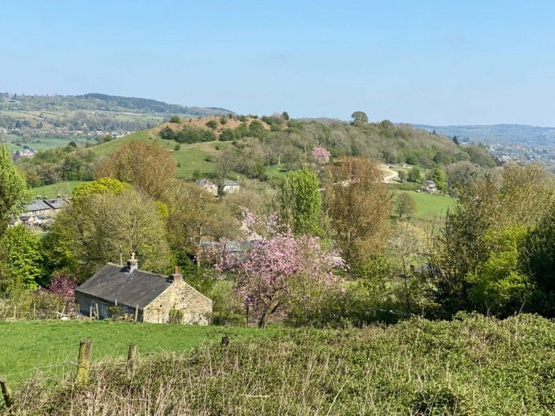
South Darley is a rural parish in Derbyshire Dales District, lying immediately west of Matlock and south of the River Derwent – see map of South Darley. It consists of the small villages of Darley Bridge and Wensley and the hamlets of Oker and Snitterton. The population was 664 in the 2021 census. Around two thirds of the parish lies within the Peak District National Park.
The parish is in limestone country, part of the White Peak, with steep hillsides, agricultural land (mainly cattle and sheep grazing) and woodland. Many of the older properties are constructed of rubble limestone with gritstone dressings and slate roofs. There were formerly several lead mines in the parish, as evidenced by the many grassy mounds and other signs of disturbance. Many of the fields are bordered by drystone walls.
The parish is now predominantly residential and agricultural, although there is a large industrial plant which recycles lead batteries. There is a church, a primary school, two village halls, a care home and a public house. The nearest shops and other services are in Darley Dale, Matlock or Winster.
The parish war memorial is located in the churchyard of St Mary’s parish church. See here for further details of the church, the churchyard and the war memorial and of two books that chronicle the life of the parish in the first half of the 1900’s.
The historic parish council records and those of the school and the church and other institutions and affairs of the parish are held either at the National Archives in Kew or the Derbyshire Records Office in Matlock.
Darley Bridge
Darley Bridge lies at the bottom of the hill below Wensley where the road crosses the River Derwent on an old three-arch stone bridge (a Scheduled Ancient Monument). Close to the bridge, the narrow road winds between stone houses in the oldest part of the village. The only public house in the parish, The Three Stags Heads, is in this area.
The village extends back up the hill with more recent houses, including a substantial line of semi-detached properties and a care home. At the upper end, known as Cross Green, there is the parish church, South Darley Primary School and South Darley Village Hall.
Wensley
Wensley is a small village of limestone and gritstone properties mainly arranged along the single road which zig-zags through the village or around the square. The whole village, together with part of the adjacent Wensley Dale is a Conservation Area. The former school is now a village hall, Wensley Reading Room. Quite a few of the houses are holiday lets.
Oker
Oker is a hamlet with groups of houses along two sides of Oker Hill. The houses are largely older limestone properties including several farms, but with some more recent semi-detached properties too. A former Methodist chapel has been converted to a holiday let.
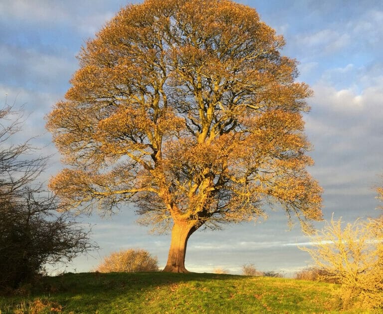
A prominent tree, known as Will Shore’s Tree, on top of the hill is renowned as the subject of a sonnet by Wordsworth, concerning two local lads who each planted a tree there before parting for ever:

“Tis said that to the brow of yon fair hill
Two brother clomb; and turning face from face
Nor one look more exchanging, grief to still
Or feed, each planted on that lofty place
A chosen tree. Then eager to fulfil
Their courses, like two new-born rivers, they
In opposite directions urged their way
Down from the far-seen mount. No blast might kill
Or blight that fond memorial. The trees grew
And now entwine, their arms’ but ne’er again
Embraced those brothers upon earth’s wide plain,
Nor aught of mutual joy or sorrow knew
Until their spirits mingled in the sea
That to itself takes all – Eternity”
Snitterton
Snitterton is a small hamlet of some fifteen properties including two working farms and Snitterton Hall. There are signs that it was once a larger village. The late 16th century Snitterton Hall is Grade 1 listed. In the centre of Snitterton there is a square stone set in the ground with an iron ring; this is an 18th century bullring, used to tether a bull for baiting with dogs.
Items of Landscape, Scientific or Historic Interest
The parish contains a considerable number of areas or buildings of landscape, scientific or historic importance.
Peak District National Park
Much of the parish lies within the Peak District National Park. The areas outside the park are Darley Bridge, the lead battery recycling plant, most of Oker and the land close to the River Derwent.
Wensley Conservation Area
The village of Wensley and parts of the adjacent Wensley Dale are designated a conservation area.
Scheduled Ancient Monuments and Listed Buildings
The following scheduled ancient monuments and listed buildings are located in the parish;
- Mount Pleasant Lead Mines, south of Wensley (Scheduled)
- Old Mill Close Engine House, southwest of Cowley Hall (Scheduled)
- Wensley Hall, Wensley (Listed Grade II)
- K6 Telephone Kiosk, Wensley (Listed Grade II)
- Three Stags Heads Public House, Darley Bridge (Listed Grade II)
- Potters Cottage, Darley Bridge (Listed Grade II)
- Darley Bridge (Scheduled)
- St Mary’s Church, Cross Green (Listed Grade II)
- Northern Dale Lead Mines, southwest of Oker (Scheduled)
- Snitterton Hall, Snitterton (Listed Grade I)
- Garden Walls of Snitterton Hall, Snitterton (Listed Grade II)
- Moated Site and Fishponds, Snitterton (Scheduled)
- Snitterton Manor House, Snitterton (Listed Grade II)
- Milestone, Snitterton (Listed Grade II)
Sites of Special Scientific Interest
The parish also contains the following Sites of Special Scientific Interest (SSSIs)
- Cawdor Quarry – Carboniferous rock exposure
- Clough Wood (and adjacent woods) – ancient woodland
- Masson Hill (and Jug Hole Cave) – cave formations and rare bats

